Khumbu valley fieldwork- 2015
By Owen King on Wednesday, March 2nd, 2016
Khumbu valley- 2015 field season.
Where?
In October and November of 2015, myself, Scott Watson, Duncan Quincey (all University of Leeds- School of Geography) and Ann Rowan (Sheffield University) were Nepal carrying out fieldwork on the Khumbu glacier and in the surrounding valley. The Khumbu valley sits high in the Himalaya at the rewarding end of the Everest base camp trail. The route, which starts at Lukla (2840 m a.s.l) airport (I use the term airport loosely- it’s a mountainside with a tiny ribbon of tarmac and a shack at one side), winds its way through ever shrinking villages up to Lobuche (our choice of campsite) or Gorak Shep from where a final stroll to base camp (5364 m a.s.l), situated at the foot of the Khumbu glacier icefall, can be made. The route is normally packed with trekkers, and provides a healthy source of income for one of the poorer countries on the planet. Since the earthquakes and aftershocks of early 2015 the route has been virtually deserted however, with foreign governments advising (even up to the day before our departure) against travel to the region. Yes, the region was shaken violently by the earthquakes, but rebuilding of both the route and villages worst hit has been swift and the terrain deemed stable. There is nothing along the route that would make you feel unsafe or uneasy following the earthquakes.
The Khumbu glacier is the ideal study site for our work because of its proximity to the amenities provided by the base camp trail, because it is an excellent representation of Himalayan glaciers generally, and because it is one of only a handful of Himalayan glaciers about which we know anything more than a name! The glacier is about 15 km long and descends from above 7000 m a.s.l. down to about 4800 m a.s.l. Everest base camp is situated about two thirds of the way up the glacier, from where hundreds of climbers and Sherpas would normally pick their way up the icefall and Western Cwm annually.
Why?
Himalayan glaciers differ from their stereotypically clean counterparts abundant in places such as the Alps, Alaska, the Rockies etc in that they can be mantled by a debris layer several metres thick. This debris can enhance ice melt if the layer is very thin, or temper ice melt if the layer is very thick, complicating how such glaciers respond to a changing climate. Currently, the majority of all Himalayan glaciers are losing mass, and they have been for some time. Figuring out just how much these glaciers might melt in years to come is of course important because they will contribute to sea level rise, but the societal impact of diminishing meltwater supply down to sea level is of perhaps greater importance to the local population. By better understanding the melt processes at work on Himalayan glaciers, we can make more accurate estimates of their mass loss and meltwater yield at different points in the future- this is our ultimate aim.
So what have we been doing?
The aims of our work for this field season were individual and varied. This past year I have been generating a lot of data from satellite imagery that has given me a good idea of how the geometry of a large number of glaciers in the region has changed over the last 15 years or so. There are a number of sources of error in satellite data however, and these are best corrected for using ground control data. Collecting this ground control data was my main focus during this trip. Essentially, I roamed far and wide in the valley with a differential GPS (thanks to the NERC geophysical equipment facility) recording the location and elevation of pre-selected targets (ground control points- GCPs) that are visible in my remotely sensed data. The same ground control points could be used should I want to look at the state of the glaciers any further back in time, using older images, or keep my observations up to date with new imagery.
Scott and Ann were looking at melt processes at the surface of the glacier. The Khumbu is peppered with huge ice cliffs that expand and collapse into supraglacial ponds as melt proceeds. It looks like the number of, and total area covered by these cliffs has increased over the past few years (the BBC took interest in our observations when we got back (http://www.bbc.co.uk/news/science-environment-34928569). Scott was examining the size and expansion rate of some of these ponds and cliffs. Ann was collecting (from previous trips) and redeploying temperature sensors in the debris layer at the surface of the glacier to examine how the temperature of this layer changes, not only over the duration of our fieldwork, but on an annual timescale. The annual timescale is important because the monsoon that hits the region in the summer months plays a big role in the mass balance of the glacier. Duncan used a novel technique called Structure from Motion (SfM) to generate a high resolution, up to date DEM of the glacier surface. My GCPs will come in handy here, too.
Success?
Touch wood, yes! We got pretty much everything ticked off fairly long to-do lists. We’ve been working through the large amounts of data and imagery we captured over the past few weeks and months and have started to produce some really nice datasets that we will be analysing pre-EGU, where we will be presenting a good chunk of our research so far.
What next?
We have another field season planned for May this year, and we are in the final stages of planning for that. Repeating our surveys then will give us a great idea of the rates at which things are changing on the Khumbu.
Holiday snaps
Photos are better than my waffle, so here are some. Take a look at our Twitter account @EverestRSSSE for more!
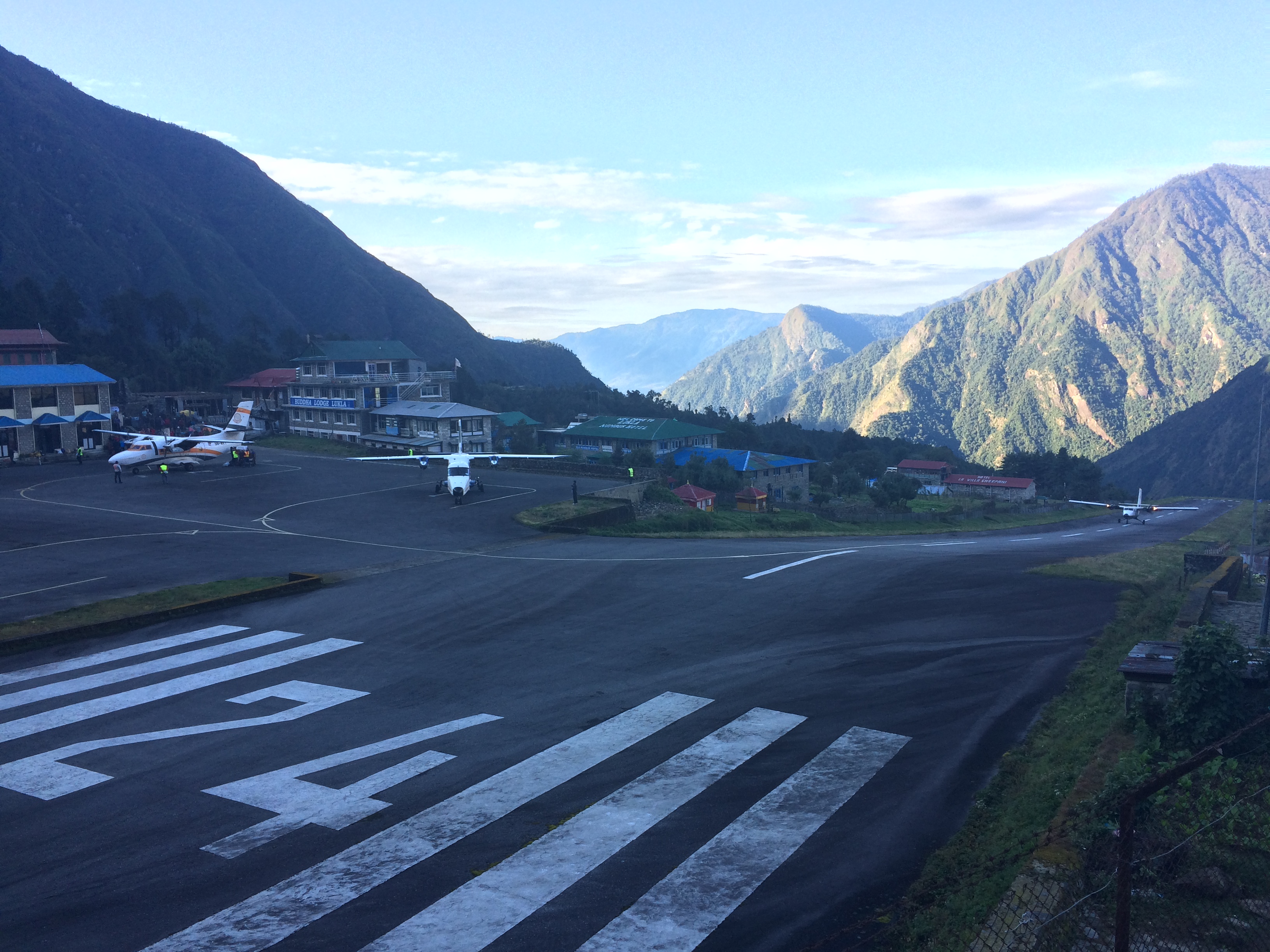
Lukla airport terminal 1, of 1.
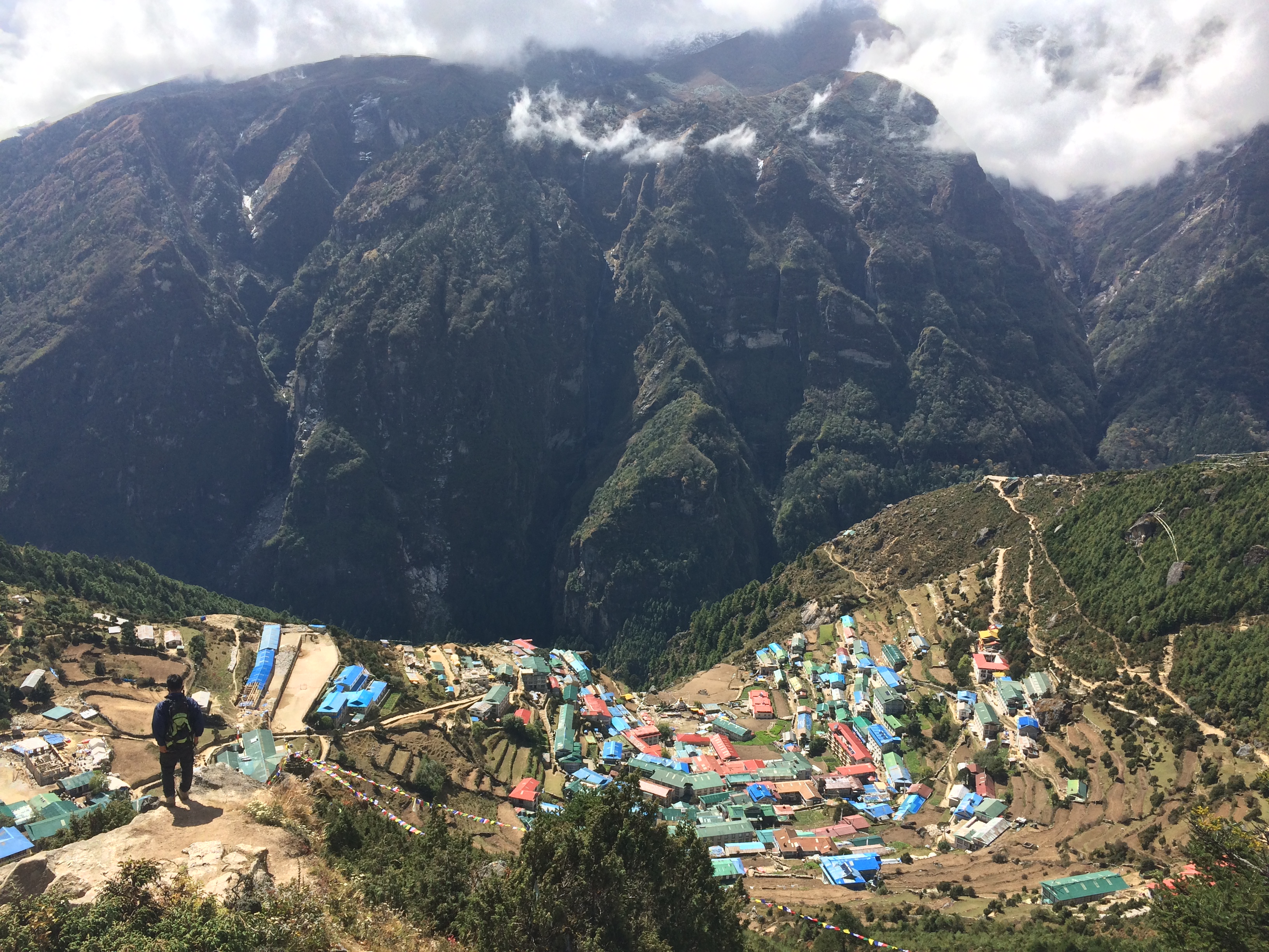
Above Namche (3400 m a.s.l), one of the stops along the base camp trail. Also the last chance of a decent cup of coffee before the return trip.
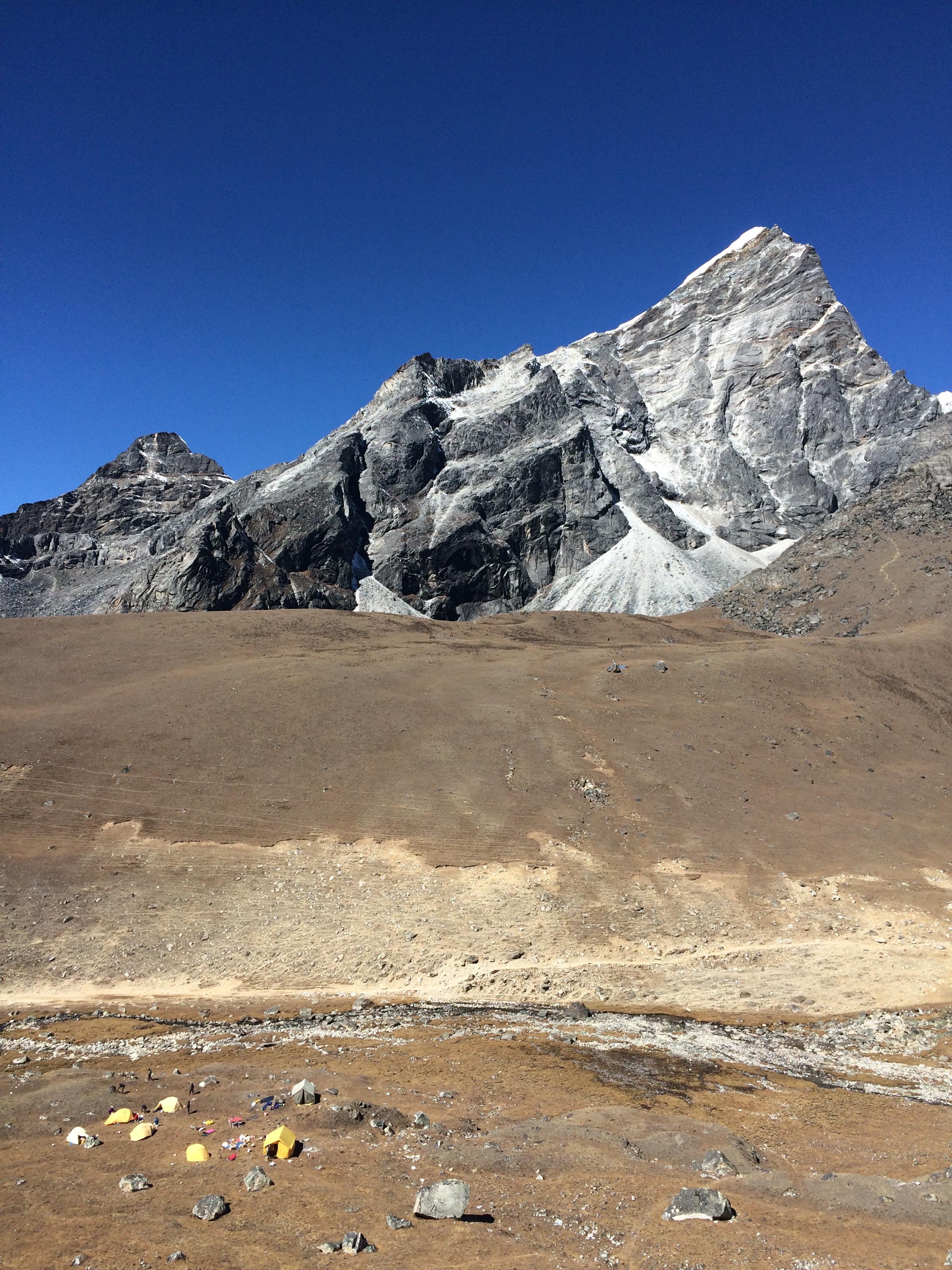
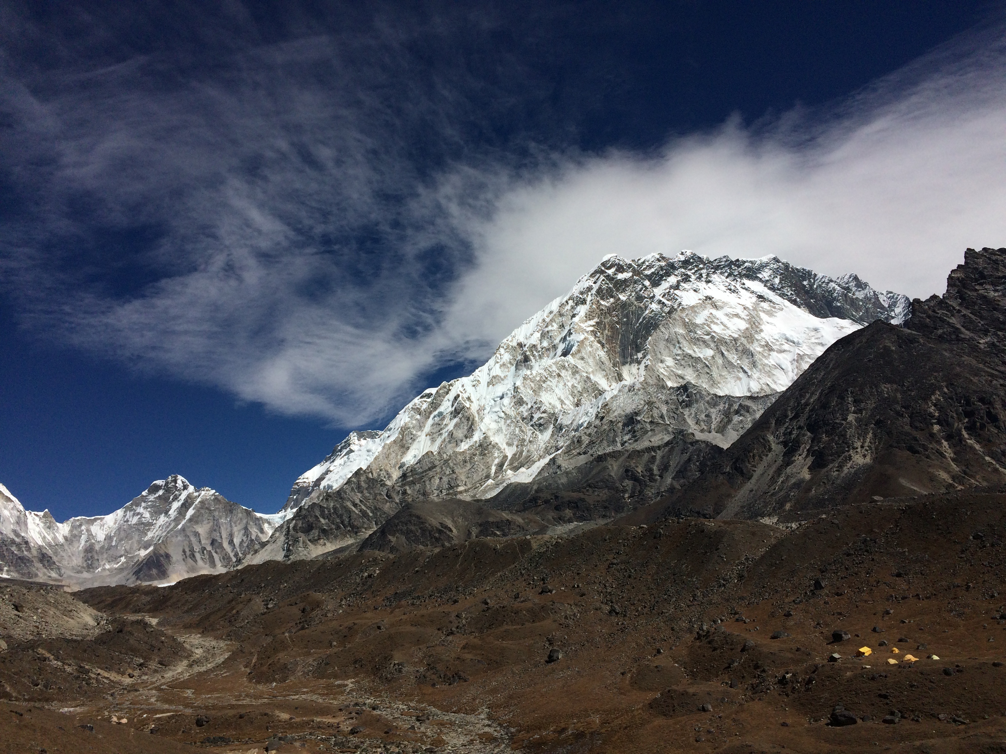
Our little camp, overlooking the base camp trail, and being overlooked by Lobuche East (6090 m a.s.l). Again below, but looking up-valley towards Nuptse (7864 m a.s.l) and Everest base camp.
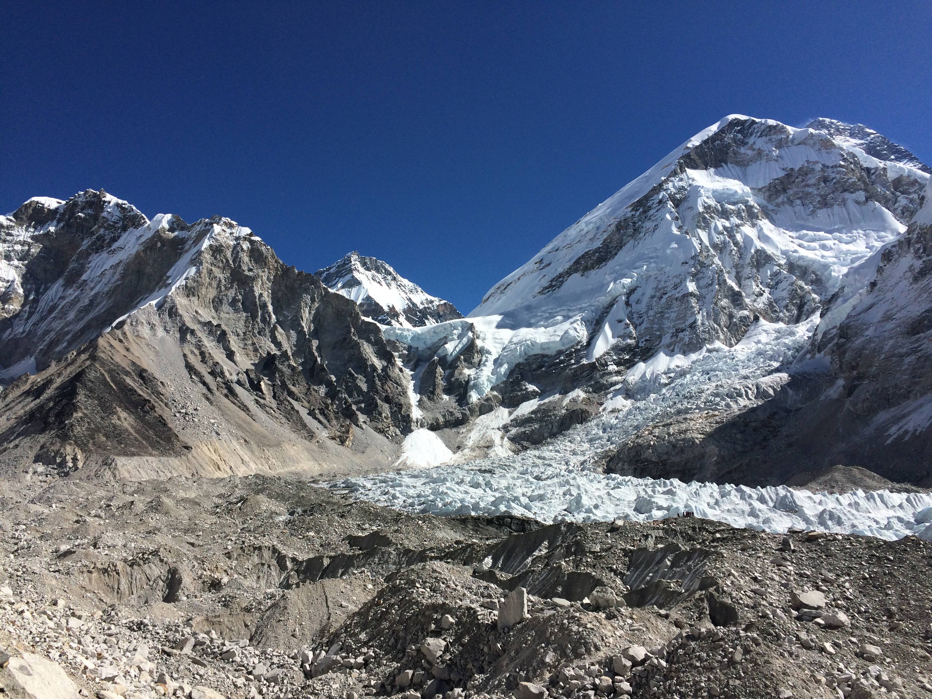
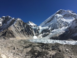
Overlooking the base of the Khumbu icefall, where basecamp is normally situated. This part of the glacier is typically packed with trekkers and climbers at different parts of the year. This morning, we were the only people around. Everest is at the back of the picture, tucked away at the back of the Western Cwn, above the icefall.
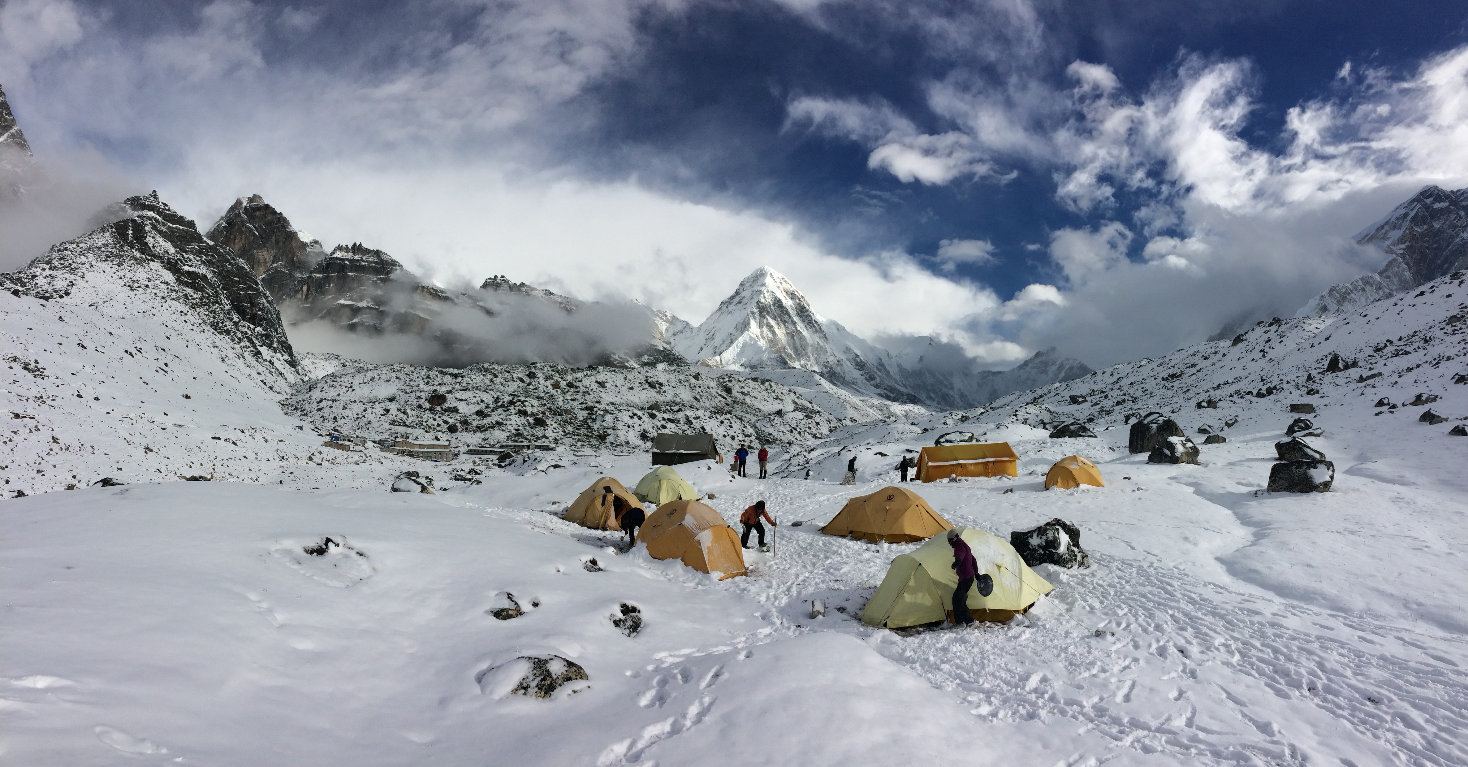
The couple of snow days provided welcome days of rest. As well as raising the temperature!